
Historical Geography Research >
Adapting to the Terrain: An Analysis of Chengdu City’s Form from the Qin to the Northern and Southern Dynasties
Received date: 2023-10-27
Online published: 2025-03-21
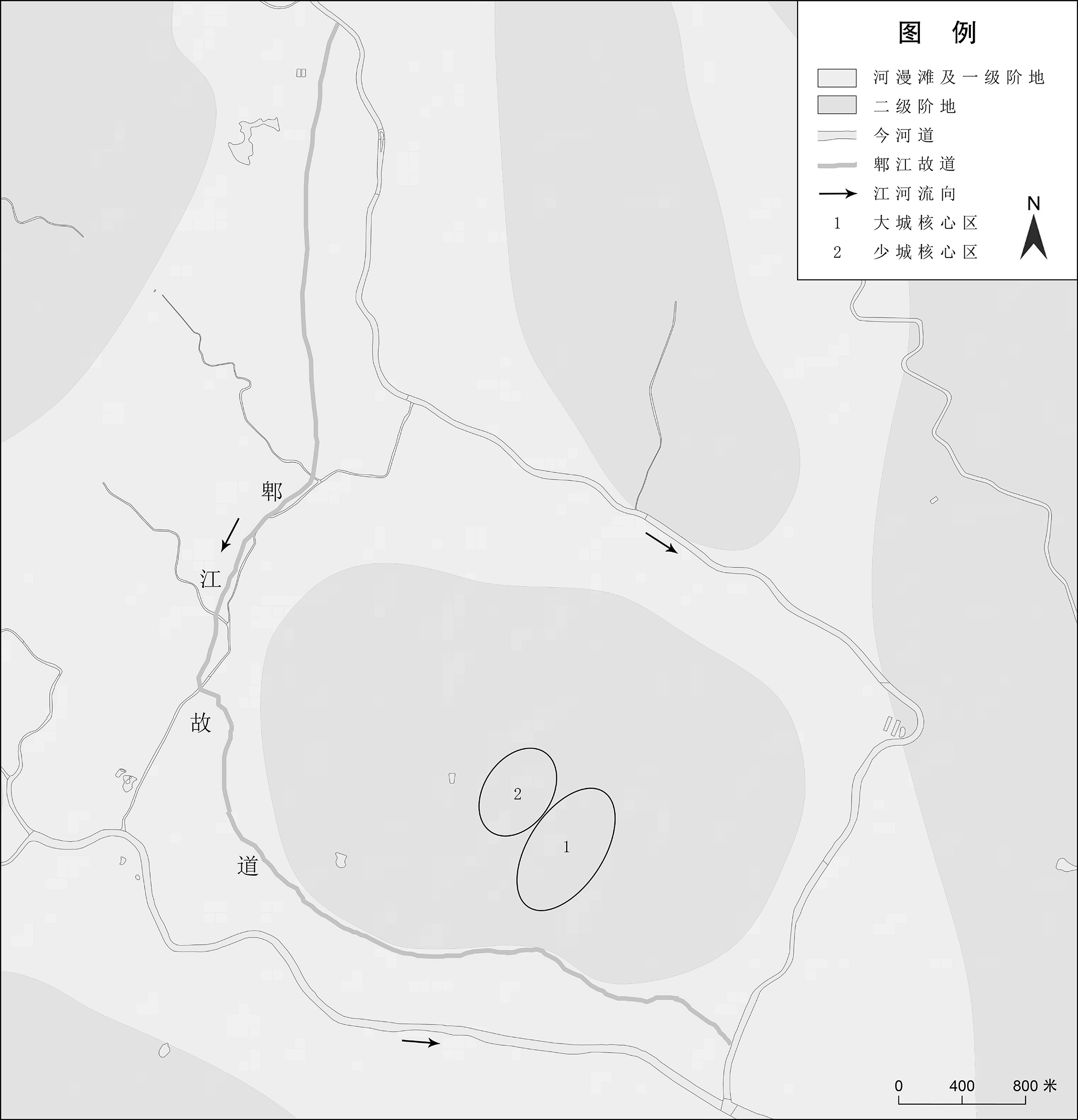
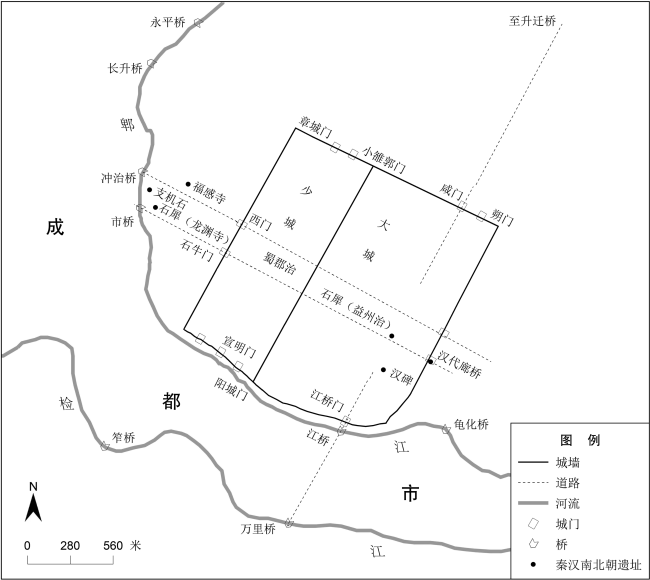
The site of Chengdu during the Qin to the Northern and Southern dynasties was located on the second terrace of the Min River (岷江) system. The scarcity of construction soil and the floods of the Pi River (郫江) were the main reasons for the formation of the ‘Tortoise City’ layout of Chengdu’s Qin city, which consisted of two cities, the larger and the smaller, arranged side by side to the east and west. The orientation of the Qin city and its internal structures followed the natural terrain, with a deliberate inclination of about 30 degrees north-east to facilitate drainage and flood control. By combining archaeological and documentary evidence, the approximate positions of the gates, walls, and central partitions of Chengdu’s Qin city can be reconstructed. The western wall of Chengdu’s Qin city was a considerable distance from the Pi River, while the southern wall was closer. The historical records mentioning 18 gates and a circumference of twelve li are considered accurate.
Key words: Chengdu; Qin City; urban morphology
Wu Lei . Adapting to the Terrain: An Analysis of Chengdu City’s Form from the Qin to the Northern and Southern Dynasties[J]. Historical Geography Research, 2024 , 44(4) : 89 -101 . DOI: 10.20166/j.issn.2096-6822.L20230363
/
| 〈 |
|
〉 |
