
Historical Geography Research >
Four Studies on the New County-level Administrative Districts of Changsha State in the Western Han Dynasty Bamboo Slips Unearthed at Zoumalou
Received date: 2023-07-12
Online published: 2025-07-16
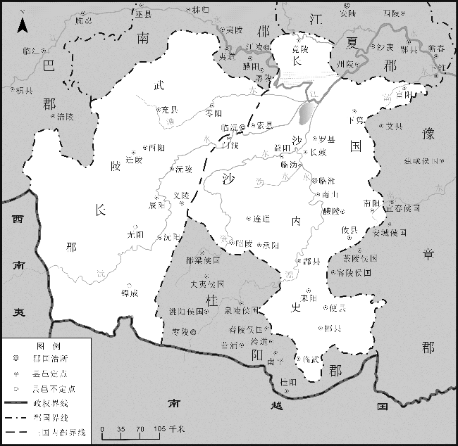
The Western Han Dynasty bamboo slips unearthed at Zoumalou (走马楼) reveal the existence of several county-level administrative districts in Changsha State during Emperor Wu’s reign, which are not documented in extant literature. Changlai (长赖) and Nanshan (南山) counties show a relationship of succession with the Linxiang (临湘) townships mentioned in the Eastern Han Dynasty bamboo slips found at Wuyi Square. Specifically, Changlai County was located near Yangshahu (洋沙湖) Village, Yangshahu Town, Xiangyin (湘阴) County, Hunan Province. Nanshan County was situated in the Zhaoshan (昭山) area, Yuetang (岳塘) District, Xiangtan (湘潭) City, Hunan Province. Fuyang (富阳) County was on the north bank of the Fushui River (富水), near Dalu (大路) Township, Tongshan (通山) County, Hubei Province. Nanyang (南阳) County was on the north bank of the Nanshui River (南水), within the area of Luxi (芦溪) Town, Luxi County, Jiangxi Province. A systematic investigation of these newly identified county-level administrative districts in the Zoumalou bamboo slips is of great significance for studying the territory and administrative divisions of Changsha State during the Western Han Dynasty.

Zhao Hailong . Four Studies on the New County-level Administrative Districts of Changsha State in the Western Han Dynasty Bamboo Slips Unearthed at Zoumalou[J]. Historical Geography Research, 2025 , 45(2) : 134 -144 . DOI: 10.20166/j.issn.2096-6822.L20230246
 。”效功亭明显属于临湘县,因而南山乡亦隶属临湘县管辖。
 乡逢门亭部李丘儛子黄$\Box$家,去县五十里;南乡逢门亭部柤唐丘儛子傅贤家,去县六
  ;南乡逢门亭部玄丘舞子李崇家,去县五十里。”此条简文部分残缺,参照“黄$\Box$家”“李崇家”去县距离的记载,“傅贤家去县”应当在六十里以上,即南乡逢门亭距离县城六十里左右。秦汉时期县域存在“都乡—方位所名乡—远乡”的分布格局③,南乡作为“方位乡”应紧邻临湘县都乡④,南山乡作为“远乡”,应在南乡以南。
/
| 〈 |
|
〉 |