×
模态框(Modal)标题
在这里添加一些文本
Close
Close
Submit
Cancel
Confirm
×
模态框(Modal)标题
×
Journal
Article
Figure
Search
EN
中文
Home
About Journal
About Journal
Indexed in
Awards
Editorial Board
Guide for Authors
Browse
Current Issue
Online First
Archive
Highlights
Topic
Archive by Subject
Most Viewed
Most Download
Most Cited
E-mail Alert
RSS
Subscribe
Contact us
EN
中文
Figure/Table detail
From Facility to Antique: The ‘Circle Field’ and Canal Projects in the Gaoyou Lake of the Ming Dynasty
Zhang Ye
Historical Geography Research
, 2024, 44(
1
): 17-31. DOI:
10.20166/j.issn.2096-6822.L20230190
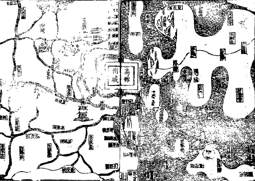
图3
隆庆年间高邮地理形势及“圈田”形态
资料来源: 隆庆《高邮州志》卷首“州境之图”,第341页。
Other figure/table from this article
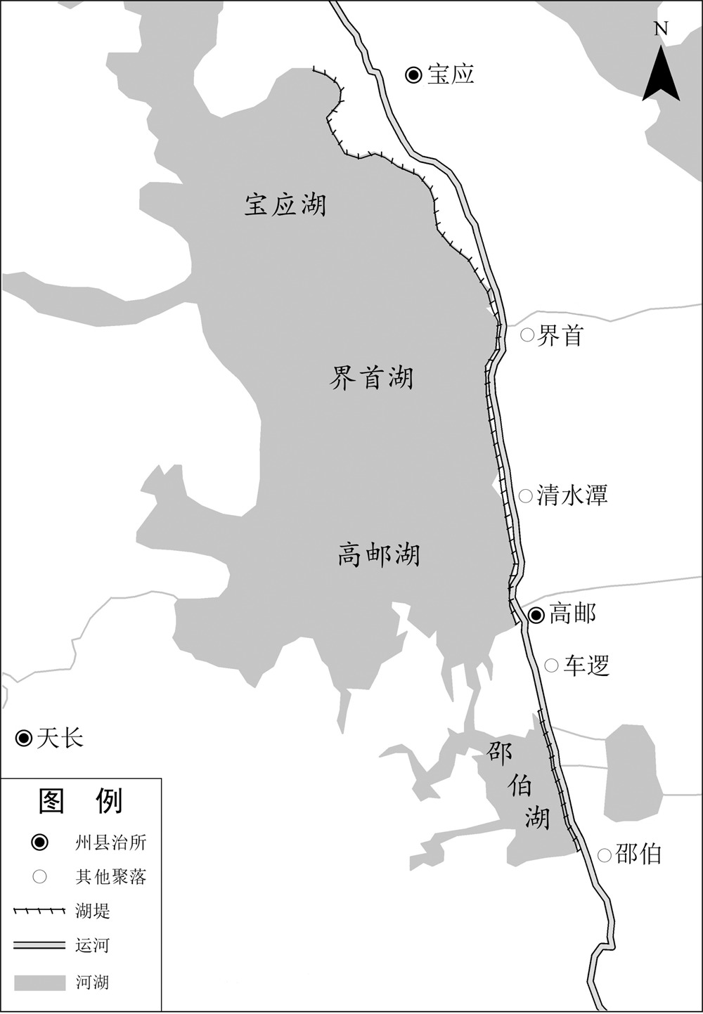
图1
明代高邮湖与运河关系示意
资料来源: 1820年河流、湖泊、城镇点数据来自CHGIS1820年层CHGIS V4数据(
http://yugong.fudan.edu.cn
)。
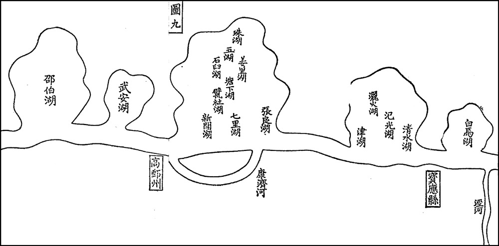
图2
弘治年间高邮康济河示意
资料来源: 〔明〕 王琼《漕河图志》卷首“漕河之图”,第5页。
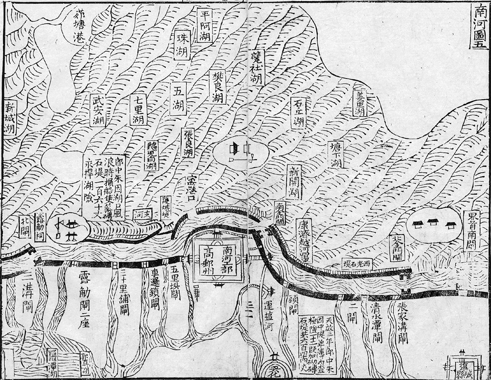
图4
明代末年高邮湖及运道形势
资料来源: 〔明〕 朱国盛《南河全考》卷首,第31a—31b页。