×
模态框(Modal)标题
在这里添加一些文本
Close
Close
Submit
Cancel
Confirm
×
模态框(Modal)标题
×
Journal
Article
Figure
Search
EN
中文
Home
About Journal
About Journal
Indexed in
Awards
Editorial Board
Guide for Authors
Browse
Current Issue
Online First
Archive
Highlights
Topic
Archive by Subject
Most Viewed
Most Download
Most Cited
E-mail Alert
RSS
Subscribe
Contact us
EN
中文
Figure/Table detail
The Transformation of Modern Chinese Map-making: Feng Guifen’s Surveying and Mapping Methods
Ren Guilei
Historical Geography Research
, 2024, 44(
1
): 123-136. DOI:
10.20166/j.issn.2096-6822.L20220078
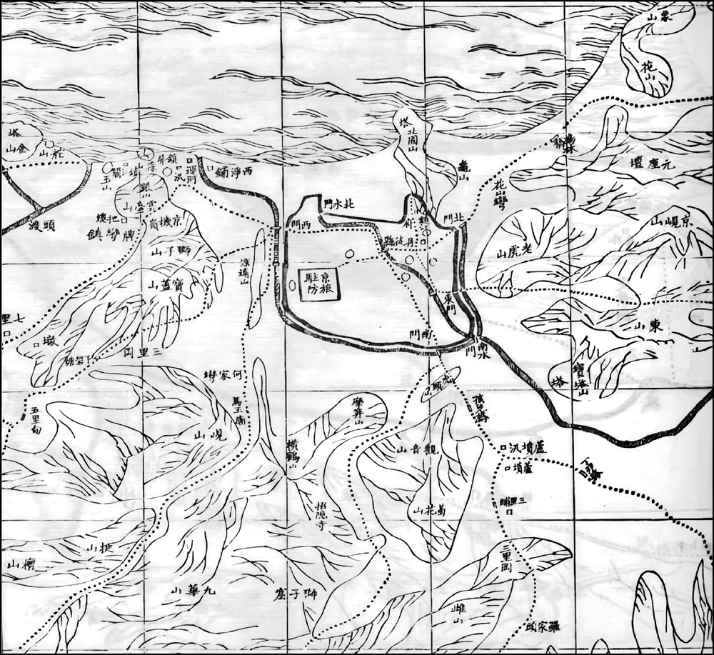
图6
《苏松常镇太二里半方舆图》(36号丹徒镇江府城附近)
资料来源: 〔清〕 江苏省舆图局《江苏全省舆图并说》,同治七年本。该舆图由复旦大学杨霄老师分享,在此致谢。
Other figure/table from this article
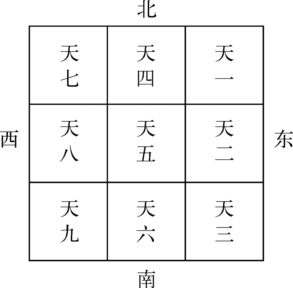
图1
“编图法”示意
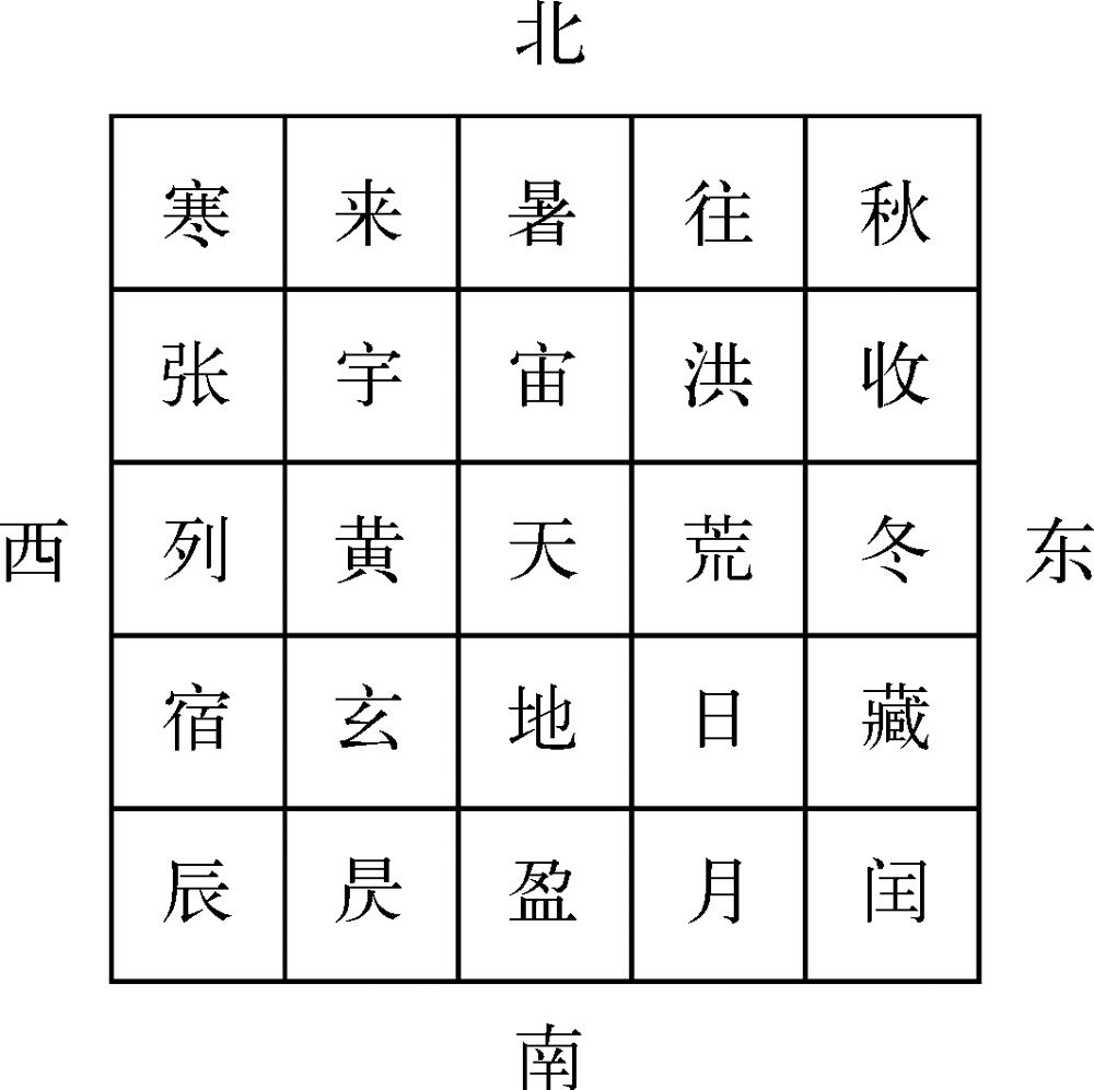
图2
“编区法”示意
资料来源: 根据〔清〕 冯桂芬《丈田绘图章程》“编图式”“编区式”绘制。
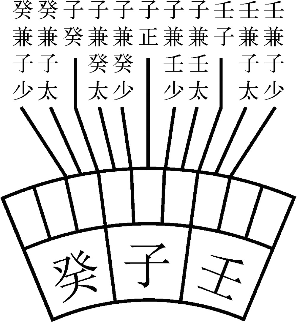
图3
反罗经样式
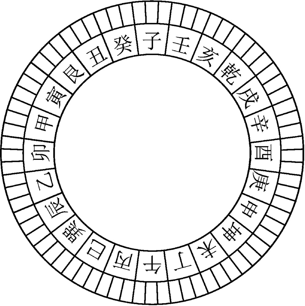
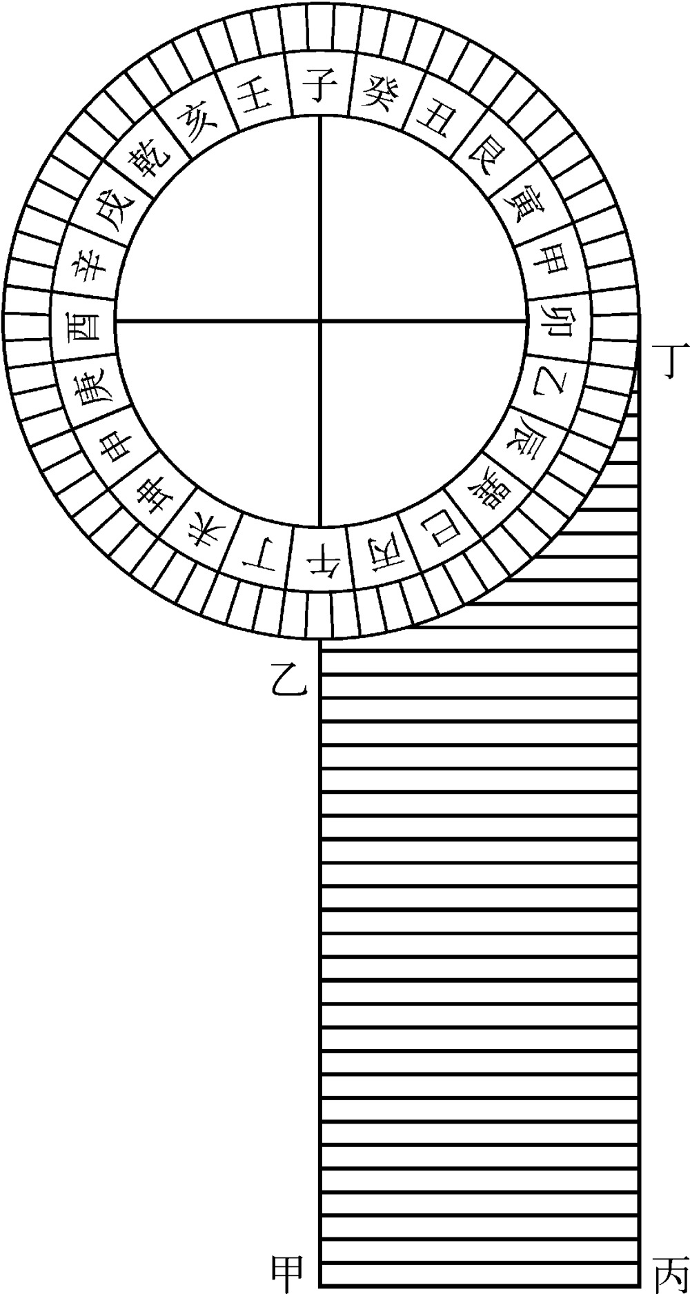
图4
“一字分六向”样式
资料来源: 〔清〕 冯桂芬著,[德] 冯凯整理,熊明心校对: 《校邠庐抗议·汇校》,第38页。
图5
定向尺样式
资料来源: 〔清〕 冯桂芬: 《校邠庐抗议·绘地图议》,第175页。